

Key Takeaways
Start here
The Big Picture: What the Pacific Northwest Actually Is
Build context
Oregon and Washington: How They Differ
Plan around weather
Climate, Seasons, and What to Expect
Choose your terrain
Key Landscapes and What Each Offers Travelers
Understand the towns
Cities, Towns, and the Urban-Rural Divide
Take action
Planning Your First Pacific Northwest Trip
The Big Picture: What the Pacific Northwest Actually Is
The Pacific Northwest is not a single landscape — it's a collection of dramatically different environments compressed into two states. Oregon and Washington together span rugged ocean coastline, ancient temperate rainforests, volcanic mountain ranges, fertile valleys, and genuine high desert. First-time visitors often arrive expecting one thing and find something far more varied.
Geographically, the Cascade Range acts as the region's defining spine. Running north-to-south through both states, the Cascades split the Pacific Northwest into a wet, green west side and a dry, open east side. This single fact explains more about the region's climate, culture, and travel character than almost anything else.
Cascade Range
A chain of volcanic mountains running north-to-south through Oregon and Washington, dividing both states into a wet western side and a dry eastern side.
Temperate rainforest
A forest in a mild, coastal climate that receives very high annual rainfall, producing dense vegetation, heavy moss growth, and year-round green — different from tropical rainforests.
High desert
An elevated, arid landscape that receives little rainfall and experiences hot summers and cold winters — the dominant terrain type in eastern Oregon and parts of eastern Washington.
Rain shadow
The dry zone on the eastern side of a mountain range, created when moisture-laden air drops its rain before crossing the peaks, leaving the leeward side significantly drier.
Timed entry permit
A reservation system used by some national parks to manage visitor numbers during busy periods, requiring travelers to book a specific entry window in advance.
Understanding this basic structure helps you stop thinking of the Pacific Northwest as one destination and start seeing it as several — each worth its own consideration.
Oregon and Washington: How They Differ
Oregon and Washington are neighbors with overlapping character but real distinctions. Washington is home to Seattle, a major international hub with a large airport and dense urban infrastructure. Oregon's largest city, Portland, is smaller but walkable, known for its neighborhoods, food culture, and accessible natural surroundings.
In terms of terrain, Washington's Olympic Peninsula contains some of the most remote wilderness in the contiguous US, including temperate rainforests that receive over 140 inches of rain annually. Oregon counters with Crater Lake — the deepest lake in the US — and a dramatically varied coastline that runs the full length of the state. Oregon's high desert in the southeast is one of the least-visited corners of either state, but rewards travelers who make the effort.
For those contrasting US regional character, it's worth noting how different this environment is from the arid landscapes covered in our American Southwest guide.
Climate, Seasons, and What to Expect
The Pacific Northwest's reputation for rain is partly earned and partly misunderstood. West of the Cascades — including Portland, Seattle, and the coast — winters are mild but persistently gray and wet, with rainfall concentrated between October and April. Summers, however, are often genuinely sunny and dry, with temperatures that feel temperate rather than hot.
East of the Cascades, the climate shifts sharply. Cities like Bend, Oregon, and Spokane, Washington, experience cold winters, warm summers, and far more sunshine than their western counterparts. If gray skies discourage you, eastern destinations may suit your travel style better.
Pack for Multiple Climates in One Trip
Even a single week in the Pacific Northwest can take you from cool coastal fog to sunny high desert to alpine trails. Layering is essential year-round. Waterproof outer layers, moisture-wicking mid-layers, and sunscreen all belong in the same bag — conditions can shift significantly within a single day's drive.
Shoulder seasons — May and October — offer real advantages: smaller crowds at popular parks, lower accommodation rates, and scenery that can rival summer. The trade-off is unpredictable weather, so packing layers and rain gear remains essential regardless of month.
Key Landscapes and What Each Offers Travelers
Breaking the Pacific Northwest into its major terrain types helps you match destinations to your interests:
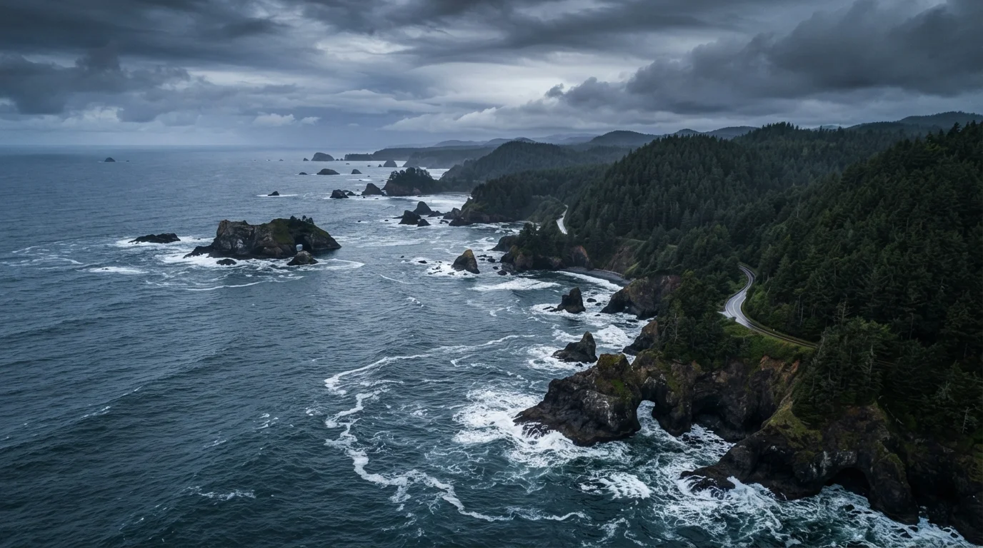
- The Coast: Oregon's entire coastline is publicly accessible — a deliberate state policy. Expect sea stacks, tide pools, fishing towns, and dramatic headlands. Washington's outer coast requires more effort but delivers genuine wilderness.
- The Cascades: Volcanic peaks dominate here. Mount Rainier, Mount Hood, and the Three Sisters attract hikers, climbers, and skiers. Crater Lake sits in a collapsed volcanic caldera and is unlike anything else in the US.
- Temperate Rainforest: Olympic National Park in Washington contains Hoh Rain Forest, one of the few temperate rainforests in North America. Moss-draped trees and extraordinary quiet define the experience.
- High Desert: Eastern Oregon around Bend, the Columbia River Gorge, and the Palouse in eastern Washington offer open skies and stark beauty completely unlike the region's green reputation.
For a broader look at how national parks across the country compare, our national parks guide breaks down what distinguishes major parks by traveler type.
Cities, Towns, and the Urban-Rural Divide
Portland and Seattle anchor the region's urban character, but the Pacific Northwest also has a strong small-town identity. Ashland, Oregon, draws visitors for its Shakespeare festival. Astoria sits at the mouth of the Columbia River with a distinct Victorian-era history. Leavenworth, Washington, has remade itself around a Bavarian theme and mountain-town tourism. Port Townsend offers Victorian architecture and a ferry connection to Olympic Peninsula trails.
One honest note for travelers: the gap between urban and rural Pacific Northwest is significant. Services, restaurants, and lodging thin out quickly once you leave the I-5 corridor or the major resort towns. Fuel up, download offline maps, and carry cash when heading into more remote areas — cell coverage is inconsistent in mountain and coastal zones.
Don't Underestimate Driving Distances
Maps of Oregon and Washington can make destinations look closer than they are. Mountain passes add time and are sometimes closed in winter. Coastal routes often follow two-lane roads that are scenic but slow. Build realistic buffer into driving days and check road conditions through state DOT websites before heading out.
Planning Your First Pacific Northwest Trip
The most common mistake first-time visitors make is trying to cover too much. Oregon and Washington together span roughly 175,000 square miles. Driving from Crater Lake to Olympic National Park takes over eight hours in good conditions. Anchor your trip in one sub-region and explore it well rather than rushing between highlights.
A practical starting framework: choose either a coast-focused trip, a mountains-and-parks trip, or an urban-plus-day-trips trip. Each approach suits different travel styles and requires different preparation. Once you've settled on a focus, our trip planning guide walks through how to build the rest of the itinerary systematically.
Entry to national parks requires fees; timed entry reservations have been required at some parks during peak season — always verify current requirements directly with the National Park Service before you finalize plans. Conditions, permit rules, and road access in mountain areas can change seasonally.
Oregon Tourism Commission (Travel Oregon)
The official state tourism resource for Oregon, offering trip ideas, regional breakdowns, and practical visitor information organized by activity and season.
Washington State Tourism (Tourism Washington)
Washington's official visitor resource covering major regions, park access, and seasonal travel considerations across the state.
National Park Service — Pacific Northwest Parks
The authoritative source for entry fees, timed-entry permits, road conditions, and current alerts for Olympic, Crater Lake, Mount Rainier, and other parks in the region.
This article provides general travel orientation and is not a substitute for verifying current entry requirements, road conditions, or park reservation policies with official sources before your trip.